Anversa degli Abruzzi
AbruzzoA medieval village at the mouth of a gorge, with a sixteenth-century church that kept a stolen triptych and, a little above, a village suspended on…

Original name: Gole del Sagittario
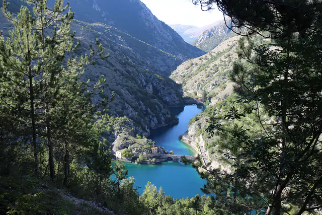
A nature reserve as long as the river that carved it: limestone rock, water running along the bottom and woods climbing to almost fifteen hundred metres. It is the passage almost everyone drives through to reach Scanno, but it deserves to be experienced on foot.
A medieval village at the mouth of a gorge, with a sixteenth-century church that kept a stolen triptych and, a little above, a village suspended on…
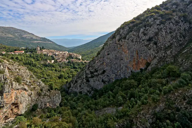
A village perched on a hill like an eagle's nest, with a medieval tower above the houses and, every year at the beginning of May, a procession in w…
A garden that shows the valley's plants, next to the small museum and the picnic area.
The sources say that practically all the Apennines' fauna lives in the reserve, with the sole exception of the chamois.
Full green, lively water and mild temperatures: one of the loveliest months for walking in the reserve.
A nature reserve as long as the river that carved it: limestone rock, water running along the bottom and woods climbing to almost fifteen hundred metres. It is the passage almost everyone drives through to reach Scanno, but it deserves to be experienced on foot.
The Sagittario Gorges (Gole del Sagittario) are one of those roads where the journey matters more than the arrival. The car glides between stone walls, then you can get out, walk to the springs, stop to look at the water. It has been a regional reserve since 1997 and, before that, from 1991, a WWF oasis: here you do not just come to “see a gorge”, you come to a corner of the Apennines protected with care.
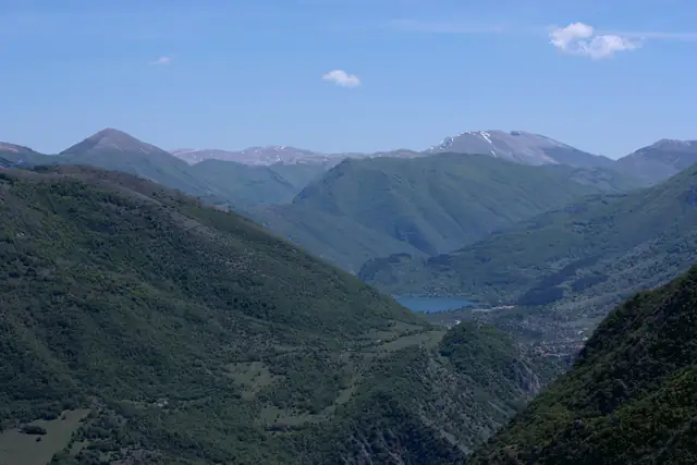
We are in the lower part of the Sagittario valley, in the province of L'Aquila, in the territory of the municipality of Anversa degli Abruzzi. The river rises further upstream, flows through Lake San Domenico near Villalago and then slips into the rock, descending towards Anversa and the Valle Peligna. The road that accompanies it is the SR 479: it is the most used access route for climbing to Lake Scanno and to Scanno itself, which is why many travellers drive through the gorges without really noticing.
The reserve covers about four hundred to four hundred and fifty hectares (sources give different figures) and rises from about five hundred metres above sea level, just downstream of Anversa, to the roughly fifteen hundred of Pizzo Marcello.
The yellow route follows the roads and links Sagittario Gorges to nearby places; the dotted line is the short connection from the road to the place.
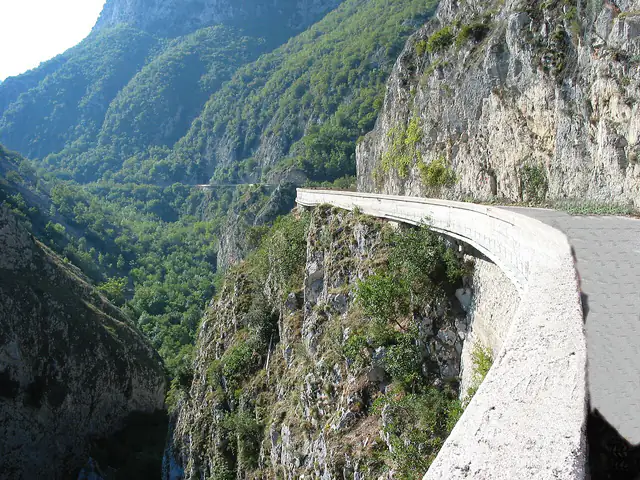
Data: © OpenStreetMap contributors (ODbL) · Relief from AWS Terrain Tiles (SRTM, EU-DEM and other open sources).The Sagittario is a river that has been patient. Its course runs through limestone and, with water and time, it has cut a narrow canyon, with walls that rise above the road and the riverbed. The road itself runs out on a ledge over the rock, in places pressed against the wall and in others hanging over the void: seen from afar it looks like a ribbon laid against the mountain.
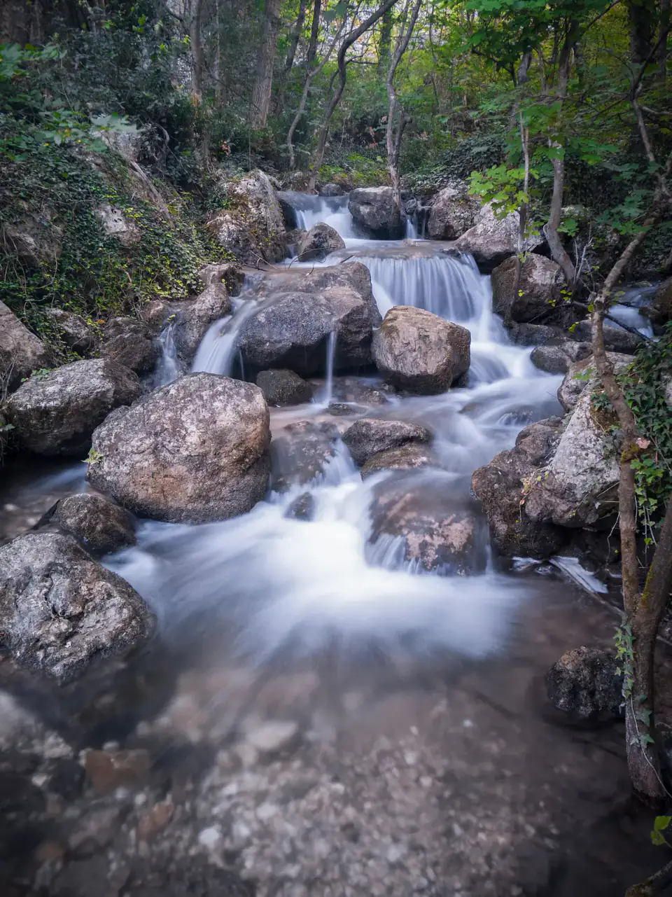
The bottom changes its face with the seasons: after rain and the thaw the water comes down loud, among rocks and small waterfalls; in drier periods the riverbed can be almost empty, and the canyon looks bigger and barer. It is a gorge you never see the same way twice.
The history of its protection is short but clear. The area began as a WWF oasis in 1991 and in 1997, with regional law no. 16 of 22 February, became a regional nature reserve. The municipality of Anversa degli Abruzzi manages it in agreement with the association: it is this collaboration, between a small mountain municipality and a large environmental organisation, that keeps the paths, botanical garden and visitor points in order.
The practical heart of the reserve is the Sorgenti del Cavuto, a municipal road that leaves the SR 479 and reaches an equipped area, with picnic tables, a small museum and the botanical garden that bears the same name. Here the water gushes out among grass and trees in a cool, green zone, a sharp contrast with the grey limestone above the road. The sources do not agree on the year the garden opened (1996 or 1999 is mentioned), but all describe it as a showcase of the valley's flora, looked after by the municipality with the WWF.
A piece of common-sense advice: parking places are very few (about ten between cars and camper vans are mentioned) and on high-season days they fill up very early. Those who go in August do well to arrive in the morning, when there is still shade and the wood is all yours.
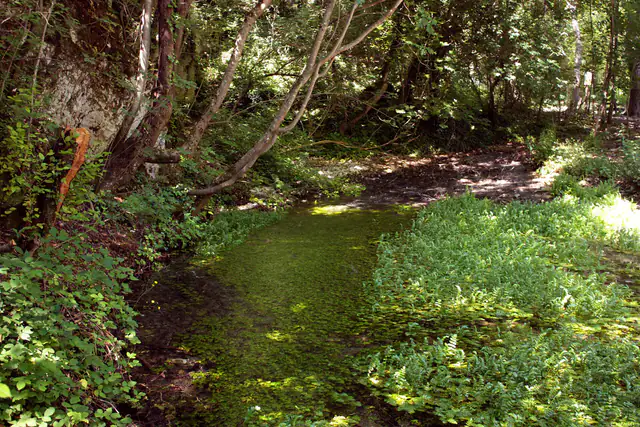
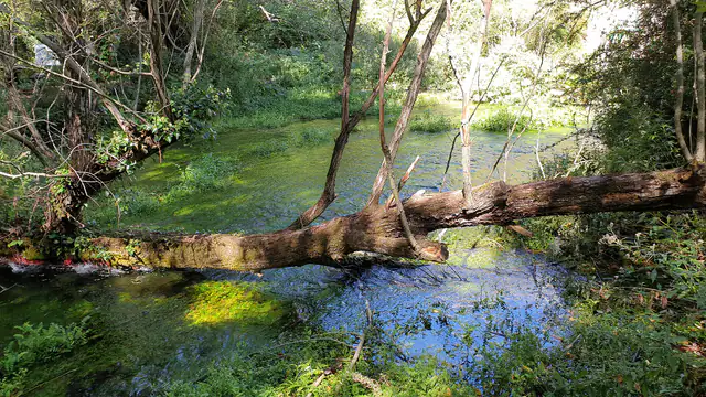
From the Sorgenti del Cavuto starts the geological trail, a loop of about seven and a half kilometres that takes about three hours; the difficulty is “E”, that is for hikers, with no technical passages. It is designed for reading the valley's geology, the rock and the work of the water.
Another marked route is the one linking Anversa degli Abruzzi to Castrovalva, the little village suspended on the rock that the Dutch graphic artist M.C. Escher made famous in his prints. It is about three kilometres with three hundred metres of climb, and takes an hour: not much, but with a steady ascent: it is best to have suitable shoes and water with you.
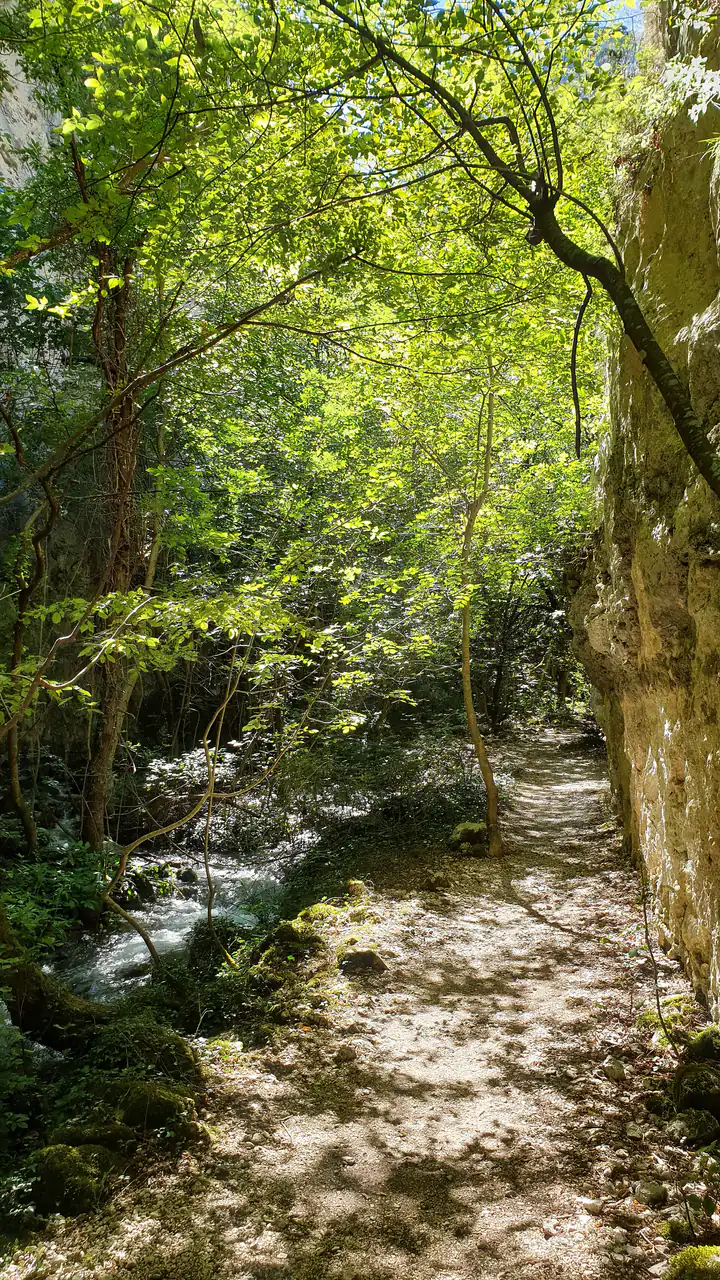
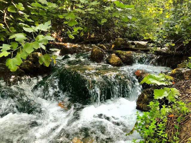
The variety of environments, from the damp valley floor to bare rocks and high-altitude woods, hosts a very rich flora and a fauna that represents almost the whole Apennines: the sources say that practically all Apennine fauna is found here, with the exception of the chamois. Among the reserve's water plants there is also the yellow flag iris.
Lake San Domenico is a short way off, with its bridge, its emerald shore and the Hermitage of San Domenico not far away, near Villalago. In the opposite direction, towards Anversa degli Abruzzi, the village offers a fine view over the valley and, a little higher up, Castrovalva. Upstream the road leads to Scanno and Lake Scanno: if you take a whole day, the gorges are the ideal first stop, before a mountain lunch.
The reserve has something to say in every season, but not the same thing. Spring brings water and greenery, and is the time when the streams have the most voice. Summer is the season of picnics at the springs and the shade of the wood, but also of crowds and a full car park. Autumn lights up the high woods and empties the paths. In winter the snow changes the landscape: it is best to find out about the condition of the road and routes before setting out. Month by month, below you will find what to expect.
On foot, between water and rock: everything the reserve lets you do.
A loop of about seven and a half kilometres starting from the Sorgenti del Cavuto: it takes about three hours, with hiker difficulty (E).
A marked path of about three kilometres, with three hundred metres of climb: it takes about an hour.
A garden that shows the valley's plants, next to the small museum and the picnic area.
The walls, the road on a ledge and the little waterfalls are the best-loved subjects; the light of morning and of autumn is the most beautiful.
Near the springs there is an equipped area for eating outdoors, in the shade of the wood.
The reserve organises guided visits, usually by reservation: it is best to check the official website before going.
Plants, rocks and animals of the valley: what you meet while walking, and what you can only imagine.
In the reserve you meet water and undergrowth plants, including the yellow flag iris.
The reserve rises to about fifteen hundred metres: the flora changes from the valley floor to the high-altitude woods.
The sources say that practically all the Apennines' fauna lives in the reserve, with the sole exception of the chamois.
The Sagittario has cut the limestone over the centuries: walls, fractures and small waterfalls show how a river works.
Best time: from May to June and from September to October. The bars show how well suited the month is: the taller, the better.
With snow the landscape changes: find out about the condition of the road and paths before setting out, and bring suitable shoes.
Still winter at altitude: the low paths are walked with caution, the days are short and you meet few people.
The thaw swells the streams: the water is louder, the undergrowth begins to wake and the paths can still be damp.
Green returns to the gorges and the water flows abundantly: a good season for the geological trail, without the heat.
Full green, lively water and mild temperatures: one of the loveliest months for walking in the reserve.
The wood gives shade and the springs are cool: walking is pleasant and the car park is not yet what it is in August.
Hot days and picnics at the springs: it is best to set out early and look for shade.
The busiest month: the sources say that at the end of August the springs' small car park is full by seven in the morning.
Fewer people and soft light: pleasant temperatures for walking and the first autumn colours in the high woods.
The woods light up in orange and red and the paths empty: perfect light for photographing the gorges.
Short days, an almost bare wood and silence: a short walk, without hurry.
Cold and short days: it is usually best to choose something else, unless you are looking only for silence.
Postcards from the area, with the straight-line distance.
Green returns and the water flows abundantly: it is the time when the river and streams have the most voice and the paths are still cool.
Shade, cool water and picnics at the springs: the reserve is a refuge from the heat, but it is best to arrive early to find a place.
The woods light up and the paths empty: the most generous season for walking and photography.
In the lower part of the Sagittario valley, in the province of L'Aquila, in the territory of the municipality of Anversa degli Abruzzi. The SR 479 runs through the gorge and is the most used access route to Scanno.
Read more: Where the Sagittario Gorges areA limestone canyon carved by the river Sagittario, today a regional nature reserve and WWF Oasis. The area has been protected as an oasis since 1991 and as a regional reserve since 1997.
Read more: From WWF oasis to regional reserveAbout 400-450 hectares (sources give different figures), from about 500 metres above sea level up to about 1,500 metres at Pizzo Marcello.
Read more: Where the Sagittario Gorges areAn equipped area with springs, picnic tables, a small museum and the reserve's botanical garden. The garden is run by the municipality of Anversa degli Abruzzi in agreement with the WWF.
Read more: The Sorgenti del Cavuto (Cavuto Springs) and the botanical gardenIt is a loop of about seven and a half kilometres that starts from the Sorgenti del Cavuto and takes about three hours; the stated difficulty is E, that is for hikers.
Read more: On foot in the gorgesYes: the marked path measures about three kilometres, with about three hundred metres of climb, and takes about an hour.
Read more: On foot in the gorgesThe springs' car park is very small (about ten between cars and camper vans are mentioned) and in high season it fills up early: it is best to arrive in the morning.
Read more: The Sorgenti del Cavuto (Cavuto Springs) and the botanical gardenThe sources indicate free entry all year round, with guided visits paid for and by reservation. The opening times reported by the various sources do not match: it is best to check on the website of the municipality or the WWF.
Read more: The Sorgenti del Cavuto (Cavuto Springs) and the botanical gardenFor good walking: May, June, September and October. In August the reserve is very busy and the car park fills up early; in winter it is best to find out about the condition of road and paths.
Read more: When to go, month by monthThe sources report that almost all Apennine fauna is present in the reserve, with the sole exception of the chamois.
Read more: Wildlife: who lives in the Sagittario Gorges
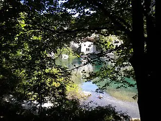 6 km
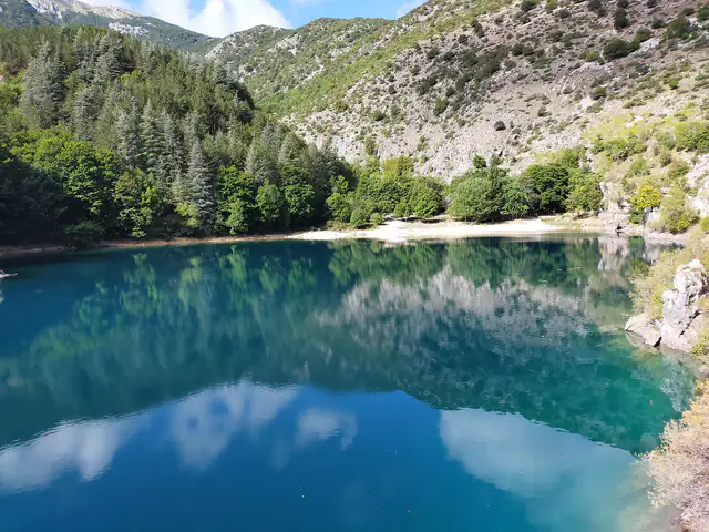 6 km
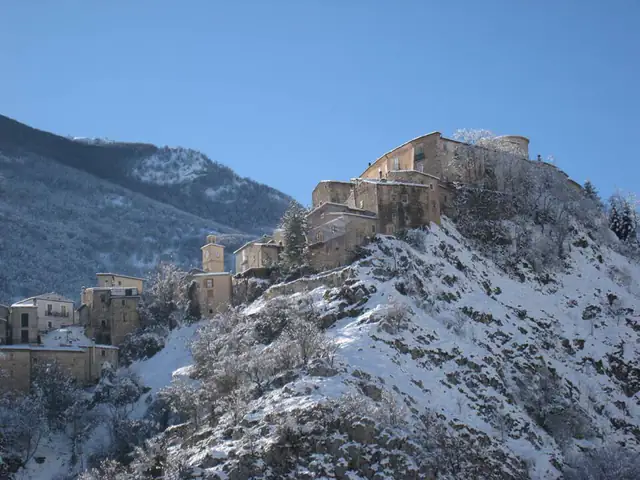 7 km
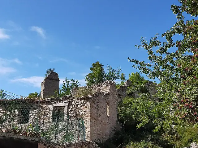 7 km
 9 km
 10 km